Whaleback Lighthouse (Whales Back, Whalesback)
Kittery, Maine
|
Location: Mouth of the Piscataqua River
Coordinates: 43 03 31 N 70 41 48 W View Whaleback Lighthouse in a larger map |
Active aid to navigation. Owned by: American Lighthouse Foundation. Managed by: Friends of Portsmouth Harbor Lighthouses.
Accessibility: This lighthouse can be seen from many spots on shore, including Fort Foster in Kittery, Fort Constitution, Fort Stark, and Great Island Common in New Castle, NH, and Odiorne Point in Rye, NH. The lighthouse is accessible only by boat and is closed to the public. Station established: 1830
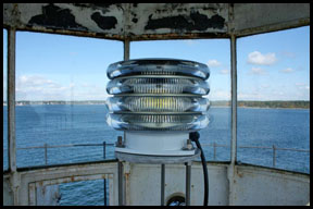
Present lighthouse built: 1872 Automated: 1963 Construction material: Granite Height of tower: 70 feet Height of focal plane: 59 feet Earlier optic: Fourth-order Fresnel lens Present optic: VLB-44 (2009) (below) Fog signal: Two blasts every 30 seconds. The fog signal is radio activated. During times of reduced visibility, mariners are requested to turn their VHF-FM radio to channel 83A/157.175MHZ. By keying their microphone five times consecutively, while on channel 83A, this will activate the fog signal for 30 minutes.
|
|
