Squirrel Point Lighthouse
Arrowsic, Maine
Click here for a gallery of Squirrel Point Light photos on SmugMug (prints and gift items available)
|
Location: Arrowsic Island, Kennebec River
Coordinates: 43 49 00 N 69 48 06 W View Squirrel Point Lighthouse in a larger map Previous lighthouse: Perkins Island Light
Next lighthouse: Doubling Point Light |
Active aid to navigation; property is leased to Citizens for Squirrel Point.
Accessibility: The lighthouse is not open to the public, but the grounds are accessible via a trail at the end of Bald Head Road in Arrowsic. Take Route 127 South from Route 1 in Woolwich and bear right at Bald Head Road. The last two miles of Bald Head Road are unpaved. There's a small parking area at the end of Bald Head Road. The walk is less than a mile, but it's fairly strenuous and takes 20-30 minutes. When you come to a fork in the trail after crossing a wooden foot bridge, follow the trail to the left. You can also view the station from across the Kennebec River in Phippsburg. From US Route 1 in Bath, take ME 209 south for six miles. Turn left on Parker Head Road in Phippsburg. After 0.3 miles, the lighthouse is visible across the river.
Station established: 1898
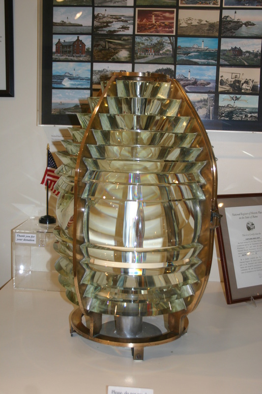
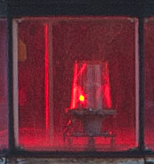
Automated: 1981 Construction material: Wood Other buildings still standing: 1898 keeper's house, 1898 barn, 1902 fog signal building, 1901 boathouse, 1906 oil house, garage Height of tower: 25 feet Height of focal plane: 33 feet Original optic: Fifth-order Fresnel lens (now at the Museum at Portland Head Light in Cape Elizabeth, Maine) (below left) Present optic: 250 mm (below right)
|
|