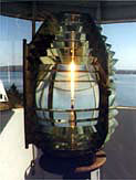
Fort Point Lighthouse
Stockton Springs, Maine
|
Location: Cape Jellison, west side of the mouth of the Penobscot River
Coordinates: 44 28 02 N 68 48 42 W View Fort Point Lighthouse in a larger map |
Active aid to navigation. Managed by: Fort Point State Historic Site
Accessibility: There is free parking near the lighthouse and Fort Pownall, within Fort Point State Historic Site. The lighthouse is not open to the public, but the grounds are accessible 9:00 a.m. to sunset in season.
Station established: 1836
Present lighthouse built: 1857 Automated: 1988 Construction material: Brick Other buildings still standing: 1857 keeper's house, 1890 fog bell tower, 1890 barn, 1897 oil house, garage Height of tower: 31 feet Height of focal plane: 88 feet |
|
