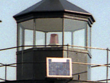
Isle au Haut Lighthouse (Robinson Point Light)
Isle au Haut, Maine
More information: History / Photos / Bibliography / Cruises / Postcards
|
Location: Robinson Point, west coast of Isle au Haut; south side of western entrance to Isle au Haut Thorofare
Coordinates: 44 03 53 N 68 39 05 W View Isle au Haut Lighthouse in a larger map Previous lighthouse: Deer Island Thorofare Light
Next lighthouse: Saddleback Ledge Light |
Active aid to navigation. The lighthouse is maintained by the Town of Isle au Haut and the Isle au Haut Lighthouse Committee. The keeper's house is privately owned.
Friends of the Isle au Haut Lighthouse Isle au Haut is accessible by ferry from Stonington. The grounds are open to the public, but the lighthouse is not.
Station established: 1907
Present lighthouse built: 1907 Automated: 1934 Construction material: Brick, granite Other buildings still standing: 1907 keeper's house, 1907 boathouse, 1907 oil house, outhouse Height of tower: 40 feet Height of focal plane: 48 feet Original optic: Fifth-order Fresnel lens Present optic: 250 mm (below) |
|
