Goat Island Lighthouse
Kennebunkport, Maine
|
Location: Cape Porpoise Harbor
Coordinates: 43 21 30 N 70 25 30 W View Goat Island in a larger map |
Active U.S. Coast Guard aid to navigation. Buildings and grounds managed by: Kennebunkport Conservation Trust
Station established: 1833
Present lighthouse built:1859 Automated: 1990 Construction material: Brick Other buildings still standing: 1859 keeper's house, 1905 boathouse, 1907 oil house, 2011 fog bell tower (reconstruction) Height of tower: 25 feet Height of focal plane: 38 feet Earlier optic: Fifth-order Fresnel lens (1859) Present optic: VLB-44 LED (2008) 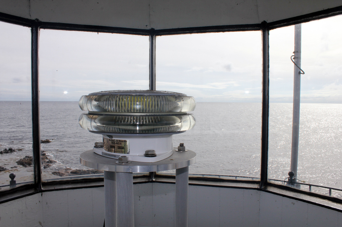
The VLB-44 (LED) optic
Characteristic: Flashing white every six seconds
Fog signal: One blast every 15 seconds (mariner activated via VHF radio) |
|