Bass Harbor Head Light
Bass Harbor, Maine
More information: History / Photos / Bibliography / Cruises / Postcards
|
Location: Southern tip of Mount Desert Island, east side of southern entrance to Blue Hill Bay
Coordinates: 44 13 19 N 68 20 14 W View Bass Harbor Head Lighthouse in a larger map |
The light and fog signal are active Coast Guard aids to navigation. The property is owned by the National Park Service as part of Acadia National Park. Accessibility: The lighthouse is at the end of Lighthouse Road off route 102A in Bass Harbor, free parking. The grounds are open to the public; the lighthouse is not. Open all year, 9:00 a.m. to sunset. To reach the lighthouse, follow Route 3 across the causeway onto Mount Desert Island. At a traffic light, bear right onto Route 102 South. Follow Route 102 through Somesville and Southwest Harbor. Follow Route 102 and Route 102A south through Bass Harbor. Where Route 102A turns left, continue straight onto Lighthouse Road and follow to the free parking area.
Station established: 1858
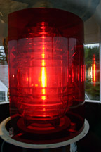
Present lighthouse built: 1858 Automated: 1974 Construction material: Brick Other buildings still standing: 1858 keeper's house, 1902 oil house, 1905 barn Height of tower: 32 feet Height of focal plane: 56 feet Original optic: Fifth-order Fresnel lens (1858) Present optic: Fourth-order Fresnel lens (1902) (below right) |
|
