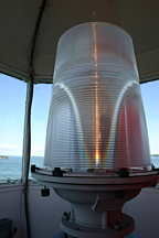
Spring Point Ledge Lighthouse
South Portland, Maine
More information: History / Photos / Bibliography / Cruises / Postcards
|
Location: West side of southern approach to Portland Harbor
Coordinates: 43 39 07 N 70 13 26 W View Spring Point Ledge Lighthouse in a larger map Previous lighthouse (south to north): Ram Island Ledge Light
Next lighthouse (south to north): Portland Breakwater Light |
Active aid to navigation. Owned and maintained by Spring Point Ledge Light Trust.
Accessibility: Click here for directions. There is limited free parking nearby, and the public may walk out on the breakwater to the lighthouse. The lighthouse is closed to the public except during open houses. Click here for the open house schedule. Station established: 1897
Automated: 1960 Construction material: Brick, cast iron Height of tower: 54 feet Height of focal plane: 54 feet Fog signal: One blast every 10 seconds
|
|
