Saybrook Breakwater Lighthouse
Old Saybrook, Connecticut
More information: History / Photos / Bibliography / Cruises / Postcards
|
Location: West side of the mouth of the Connecticut
River.
Coordinates: 41 15 48 N 72 20 34 W View Saybrook Breakwater Lighthouse in a larger map |
Accessibility: The lighthouse is privately owned. It is not open to the
public and is best viewed by boat.
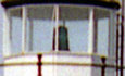
Station established: 1886 Present lighthouse built: 1886 Automated: 1959 Construction materials: Cast iron with brick lining Height of tower: 49 feet Height of focal plane: 58 feet
Characteristic: Flashing green every six seconds (active U.S. Coast Guard aid to navigation)
Fog signal: One blast every 30 seconds Previous lighthouse (west to east): Faulkner's Island Light Next lighthouse: Lynde Point Light |
|